The Lauter valley cycle route
Vélo Strasbourg et nord
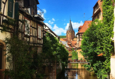
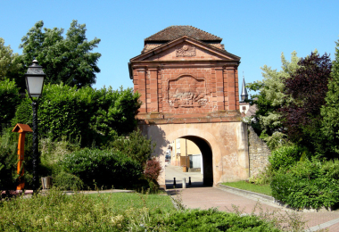
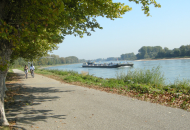
From Hinterweidenthal, the cycle route follows the course of the Weisslauter ¿the white Lauter¿, overhung on both sides by huge, strangely shaped pink sandstone rocks. Beyond Dahn, the valley gradually narrows and the woodland becomes more and more dense. On leaving the forest, the cycle route reaches the town of Wissembourg, whose ramparts contain architectural treasures. Dominated by the abbey church of St-Pierre-et-Paul, its half-timbered houses are reflected in the waters of the Lauter, which flows right through it. Towards the east the valley widens and, once past the Hardt racecourse, the cycle route follows the old Lauter lines, an 18 km long defensive structure built during the War of the Spanish Succession. In Lauterbourg, a charming fortified town located at the eastern tip of Alsace, it joins the Rhine forests and nature reserves and joins the Rhine Bike Route - EuroVelo 15.
Gallery