Légende
Bicycle paths
On-road cycle lanes
Shared circulation
Road
Cycle trails / Local circular cycle trails -50 km
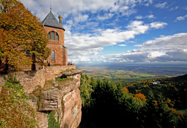
BL683 - At the foot of Mount Sainte-Odile
Distance
31,5 km
Difficulty
Occasional practice
Elevation
215 m
After the vast fields of cabbages, come the picturesque villages along the Wine Route followed by majestic Mont Sainte-Odile convent. Many cultural stops are dotted along the way with countless sign-posted rambling trails.
Gallery