Légende
Bicycle paths
On-road cycle lanes
Shared circulation
Road
Cycle trails / Local circular cycle trails -50 km
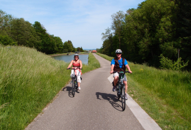
BL106 - Around the canal, the gateways to Sundgau
Distance
41 km
Difficulty
Occasional practice
Elevation
267 m
The Rhône-Rhine Canal carves a furrow through Alsace from its entry point at Valdieu, at 350 m in altitude to Brunstatt at 250 m in altitude. As you cycle along its banks from lock to lock, between Wolfersdorf and Illfurth, you can easily imagine the pace of life of the canal boatmen of yore. The trail also follows the former railway lines along the rivers Ill and Largue reminding us of a time when it was usual to travel to the Sundgau by train.
Gallery