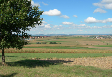
Through the "Kochersberg" area
The route which links Wolfisheim and Mittelhausbergen runs alongside the fortified ring of the Alsatian metropole. Beyond Pfulgriesheim, begins the Kochersberg, the "grainstore" of Alsace. The large expanses of land covered by crops are punctuated by round hills. Numerous villages are scattered around this region, which is also known as '"tarte flambée" country. They have preserved some handsome rural buildings from the 16th and 19th centuries. The vines appear from Osthoffen-Dahlenheim onwards and stretch over the Mossig hills, on the slopes of Mont Scharrach. Numerous plain castles line the Val de Bruche valley: at Ernolsheim-sur-Bruche, Kolbsheim, Breuschwickersheim, ... The return route to Wolfisheim follows the banks of the Mossig, then the Bruche Canal built by Vauban to carry the stones necessary for the construction of the citadel of Strasbourg.
Gallery